Start: 01/01/2014
End: 31/12/2014
Funding: National, Industrial
Status: Completed
End: 31/12/2014
Funding: National, Industrial
Status: Completed
Research unit:
Remote Sensing (RSE)
Acronym: GRD
Remote Sensing (RSE)
Acronym: GRD
The GRD project is focused on ground movements related to landslides and other ground instability phenomena occurring in the Sierra Nevada area. It involves two types of activities:
A) Differential SAR interferometry (DInSAR): processing and analysis of single differential interferograms. This includes:
- The acquisition of SAR images from the sensors ALOS Palsar and ASAR Envisat.
- The SAR image preprocessing and the differential interferogram computation.
- The joint analysis of the interferograms, which involves the CTTC staff and the experts of the University of Granada.
B) Advanced DInSAR: Persistent Scatterer Interferometry (PSI). This includes
- The design of a redundant network of interferograms.
- The pixel selection.
- The estimation of the deformation velocity maps
- The estimation of the deformation time series.
- The joint analysis of the results interferograms, which involves the CTTC staff and the experts of the University of Granada.
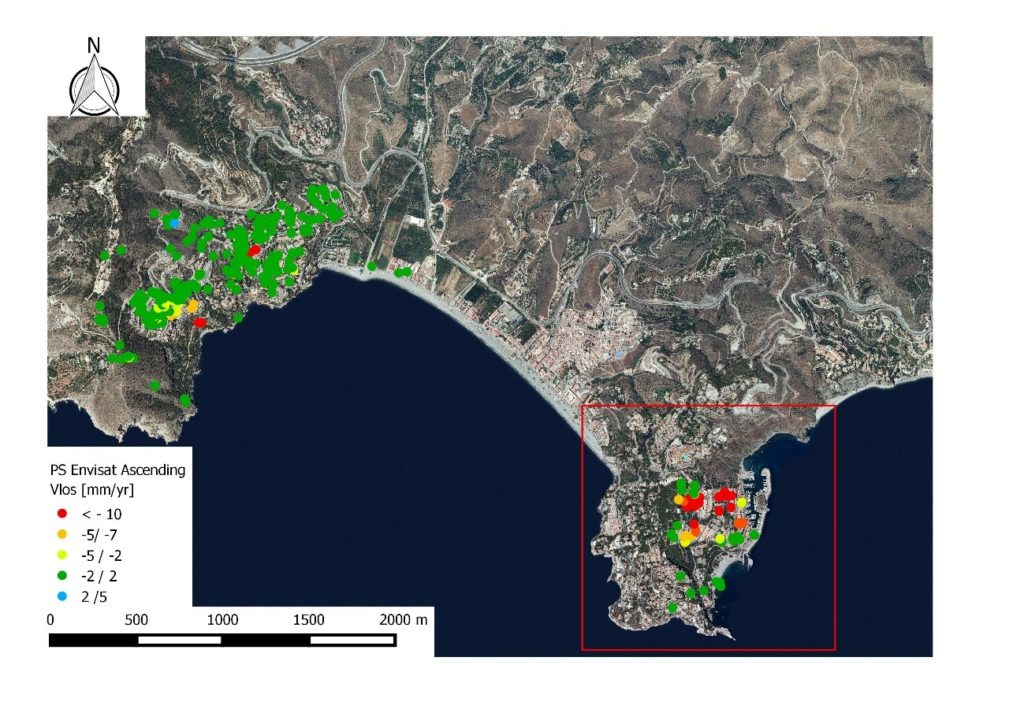
Figure 1 illustrates an example of deformation velocity map superposed to an orthoimage.
Michele Crosetto
Researcher
Oriol Monserrat
Researcher
No results found
No results found
