End: 31/12/2016
Funding: National
Status: Completed
Geodesy and Navigation (GEON)
Acronym: MIDES
Call ID: CGL2013-43000-P
Code: CGL2013-43000-P
The MIDES project is based on DInSAR (Differential Interferometric Synthetic Aperture Radar, DInSAR), a satellite based remote sensing technique to measure deformation of terrain, structures and infrastructures. In particular, MIDES is focused on the exploitation of the high application potential of this technique in different fields of earth sciences and engineering. The potential is due to two key factors: the advances in DInSAR processing algorithms and the extraordinary growth in the acquisition capability of the new SAR sensors. However, this potential is reduced by the limited analysis capability of big data volumes, for the difficulties in understanding the DInSAR results and for the complexity of the work needed to analyse these results.
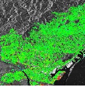
The aim of the MIDES project is to develop and implement an interdisciplinary methodology to systematically monitor and analyse the deformations of terrain, structures and infrastructures over wide areas. The goal is to cover areas of one thousand square kilometres with high-resolution sensors and up to tens of thousands square kilometres with the new satellite Sentinel of the European Space Agency, see the Figures 1-4 in Annex II. The list of potential application is wide, for the number of phenomena that can cause deformations. Important examples are given by landslides, subsidence due to natural causes, human-induced subsidence caused by fluid extraction, underground excavations (tunnels, mines, etc.), inactive mines, seismic and volcanic activity and the phenomena of instability of structures and infrastructures.
The project is organized along three main axes:
1) Study and implementation of a DInSAR analysis methodology to process huge data volumes and hence cover wide areas. For this purpose new algorithms and new DInSAR software tools are needed, along with new processing procedures.
2) Analysis, characterization and validation of the satellite DInSAR data. These aspects are important for a correct exploitation of the DInSAR data, especially if this has to be performed systematically and over wide-area using a multidisciplinary approach.
3) Development of a methodology to analyze, interpret and exploit systematically the deformations measured by DInSAR. This component requires a multidisciplinary approach encompassing DInSAR remote sensing, geomatics and different disciplines of earth science and engineering concerned with deformations.
The project is based on eight work packages, one for management and coordination and another for dissemination of the results. Project activities will be developed around two areas of study: the Barcelona metropolitan area (high resolution data) and Catalonia (Sentinel data). The MIDES project has a total of nine researchers, of which seven are doctors with experience. Three of them come from foreign institutions.
